Velorino
Your companion for your next cycling tour, powered by over 2.000 POIs across Austria, it helps you discover public water dispenser, snack stations, and self-service bike stations. So, no matter if you need to refill your bottles, take a quick snack-break, or if you need to fix something on your bike, Velorino got you covered with the needed information.
2025 – Today
·
Design, Research, Development
Introduction
Velorino is an iOS app that leverages native iOS technology to give myself (and maybe others) easy and quick access to POI data to discover water dispenser, snack stations, and self-service bike stations while being out on a ride. Additionally, it provides detailed information about each POI, simple interactions to navigate to the POI, the possibility to favorite them, as well as upload your own routes via a .gpx file, so Velorino can analyze the route, and show you the POIs along that route. It is free, available on the App Store, no data is getting shared with third-parties, everything happens locally on your device, and is available offline.
The goals
For a couple of years now, I spend a significant amount of my free-time out on my road cycle, discovering new routes, new areas, and simply enjoying my time out in nature. As I am also trying to push myself to new limits, I am constantly increasing the length of my routes to over 100km, even trying to get to 120km. The most important bit about such cycling trips is to plan ahead accordingly when it comes to food and drinks to stay energized, as well as having the right tools with me to fix any kind of problems with my road cycle. But since I am limited in what I can carry, I always rely on public water dispenser or snack stations to grab some stuff. Finding those within Apple Maps has always been clunky, and additionally, because of missing information, it also led to frustrated detours to reach a snack station which no longer existed. Therefore, I decided to build Velorino, a simple and beautiful app to quickly and easily view POIs on a map interface, in order to find public water dispenser, snack stations, and self-service bike stations.
Gather POIs in a familiar interface
Make the POIs accessible, fueled with relevant information
Make it easy to navigate to the POIs, and do not limit users to a single option
Quickly filter for different POI categories and states (focussing on Austria first)
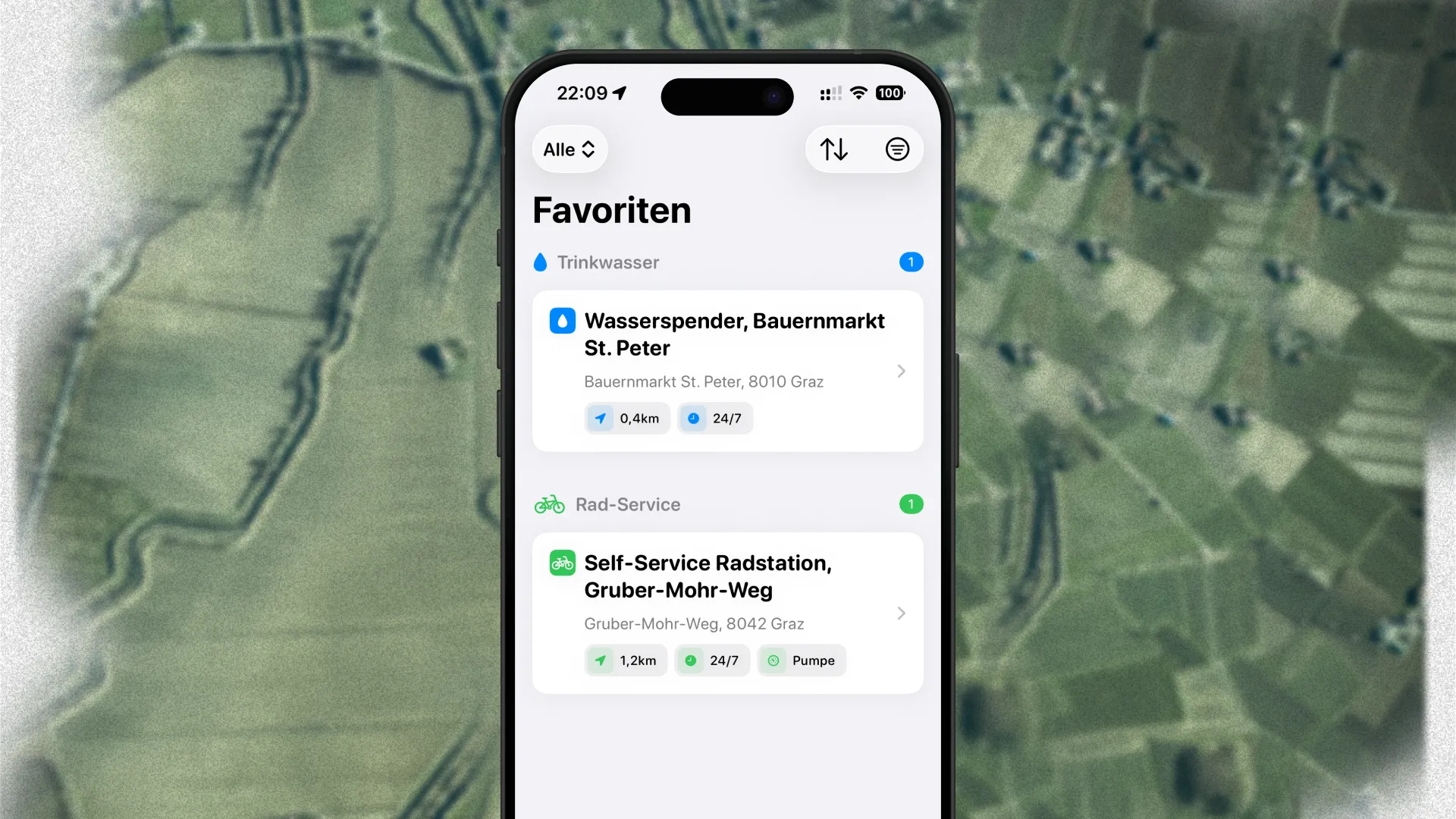
Allow users to favorite POIs, in case they are riding a specific route multiple times
Give users the possibility to upload their routes via .gpx, analyse it, and show POIs along that route
Research
While cycling around, discovering new routes, I started collecting POIs like public water dispensers, snack stations, and self-service bike stations within Apple Maps and added them all to a personal list. Although, I ride my road cycle a lot, gathering data for all those POIs that way is not feasible. Therefore, I sat down and started my research regarding where to get data about POIs that could potentially fuel Velorino.
Where does the data come from?
How do I process the data within Velorino?
How do I maintain the data?
Process
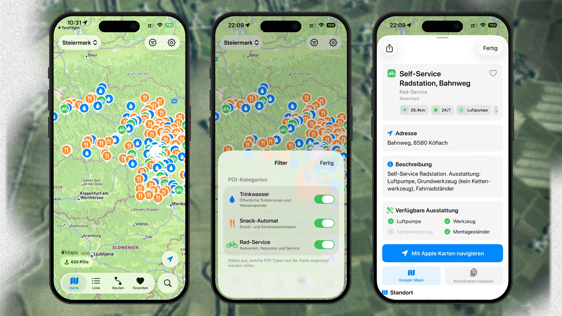
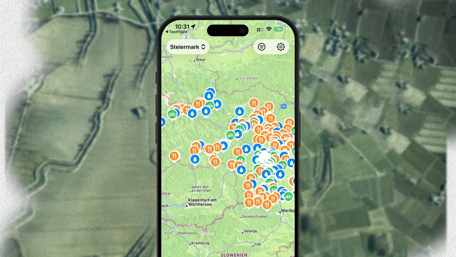
I did not want to reinvent the wheel for the main view for Velorino, and rather stick with established patterns, os-specific design principles, and native technology. Velorino leverages modern iOS design standards, adapting Liquid Glass, and is fully built in SwiftUI. It consists of five tabs:
Map: to view the POIs on a map.
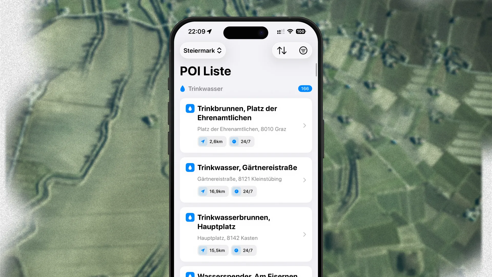
List: to view the POIs in a list.
Routes: to upload .gpx files and save them in a list view.
Favorites: to access favorited POIs quickly.
Search: to search through states, routes, and POIs.
I decided that the main interaction point is the Main Map View, where all the POIs within a single state are getting displayed. All POIs are structured within .geojson files, one file for each state. This way, it is easier to maintain and manage the data, compared to having a single JSON including the data for all states. Since I am not expecting that many new POIs throughout the upcoming months, I did not want to deal with dynamic or more complex setups by providing the data through a database like Supabase.

Solution
Velorino is your smart companion for cycling tours in Austria. It provides over 2.000 POIs sourced from OpenStreetMap and licensed under the Open Database License (ODbl). The POIs are visible on a familiar map interface, powered by Apple's native MapKit. You can quickly filter with a state selector, as well as choose to only display a specific POI category (water dispenser, snack station, or self-service bike station). Velorino helps you to find POIs while being out on a cycling tour, to fill up your water bottles, grab a quick snack, or fix a small problem with your cycle at a self-service bike station.
Besides the map, you can also view all the POIs within a list, having access to the same filters as on the map view. Tapping on a POI from the map or the list view pulls up a POI detail view showing all the important information at a glance. From that detail view, you can also quickly navigate to the POI with Apple Maps or Google Maps, or copy the coordinates in order to navigate with a different app. You can quickly add a POI to your favorites to have quick and easy access to it, in case you are riding the same route multiple times. In order to plan ahead your next tour, you can upload your route as a .gpx file, Velorino will analyze it, and provide you with the POIs along your route, so you know where you can stop in order to fill up your water bottles.
Velorino is available for iOS, and if you want to test out new features early, you can also join the TestFlight.